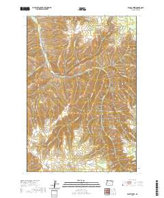
2020 Map of Bassey Creek
USGS Topo · Published 2020About this map
McKay serves as the primary landmark in this upland corner of Umatilla County, where the terrain is defined by the complex drainage systems of the Blue Mountains. The landscape is characterized by a series of high-elevation ridges and deep creek beds, including Calamity Cr in the northern reaches of the quadrangle. The map illustrates the rugged land-use patterns typical of this part of eastern Oregon, where isolated outposts and high-country waterways dictate the placement of local roads. While the area is sparsely settled, the topographic detail provided by the U.S. Geological Survey reveals the intricate relief of the basalt-rich plateau and its relationship to the seasonal flow of mountain streams.
Find a feature on this map
2 named features on this map. Tap any name to fly to it.
Don’t see what you’re looking for? This feature index may not catch every label — zoom into the map to look around manually.
Map Details
Editions of this 2020 Bassey Creek Map
This is the sole edition of this map. No revisions or reprints were ever made.
Other maps of this area

1935 · Pendleton
USGS Topo · 1:125,000

1953 · Pendleton
USGS Topo · 1:250,000

1956 · Pendleton
USGS Topo · 1:250,000

1963 · Meacham Lake
USGS Topo · 1:24,000

1964 · Mc Intyre Creek
USGS Topo · 1:24,000

1964 · Meacham
USGS Topo · 1:24,000

1966 · Cabbage Hill
USGS Topo · 1:24,000

1966 · Table Rock
USGS Topo · 1:24,000
1967 · Bassey Creek
USGS Topo · 1:24,000

1967 · Bally Mountain
USGS Topo · 1:24,000