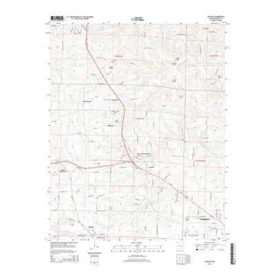
2014 Map of Batavia
USGS Topo · Published 2014About this map
Batavia and the northwestern outskirts of Harrison anchor this Boone County landscape, where the Ozark plateau is deeply etched by a network of drainage forks and family-named hollows. The settlement pattern follows the high ridges and valley floors, connected by historic routes like Old Hwy 65 N and the modern Us-65. For local historians and genealogists, the map is remarkably dense with family burial grounds, including Gass Cem, Loback Cem, and Sanders Cem, often located near small communities such as Ridgeway and Prosperity.
Find a feature on this map
66 named features on this map. Tap any name to fly to it.
Don’t see what you’re looking for? This feature index may not catch every label — zoom into the map to look around manually.
Map Details
Editions of this 2014 Batavia Map
This is the sole edition of this map. No revisions or reprints were ever made.
Other maps of this area

1904 · Harrison
USGS Topo · 1:125,000

1905 · Harrison
USGS Topo · 1:125,000

1945 · Harrison
USGS Topo · 1:250,000

1949 · Harrison
USGS Topo · 1:250,000

1954 · Harrison
USGS Topo · 1:250,000

1958 · Harrison
USGS Topo · 1:250,000

1964 · Harrison
USGS Topo · 1:250,000
1966 · Omaha NE
USGS Topo · 1:24,000
1967 · Gaither
USGS Topo · 1:24,000
1967 · Bergman
USGS Topo · 1:24,000