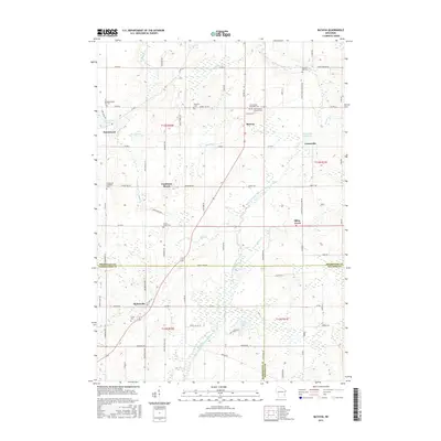
2015 Map of Batavia
USGS Topo · Published 2015About this map
The North Branch Milwaukee River and its various tributaries, including Mink Cr and Silver Cr, dictate the geography of this Sheboygan County landscape. The area is defined by small, historically rooted settlements such as Batavia, Beechwood, and Gooseville, each connected by a network of county roads like Co RD SS and Co RD A. Local history and genealogy are anchored by several legacy burial grounds, including the Winfield Cem and Scott Union Cem. The terrain features numerous water bodies and wetlands, notably the Cranberry Marsh and the Gooseville Millpond, which reflect the region's glacial hydrology. Further south, Boltonville sits near the crossing into Washington County, while markers like Indian Mound Rd hint at much earlier layers of human habitation in the territory.
Find a feature on this map
81 named features on this map. Tap any name to fly to it.
Don’t see what you’re looking for? This feature index may not catch every label — zoom into the map to look around manually.
Map Details
Editions of this 2015 Batavia Map
This is the sole edition of this map. No revisions or reprints were ever made.
Other maps of this area

1892 · Port Washington
USGS Topo · 1:62,500

1904 · West Bend
USGS Topo · 1:62,500

1904 · Port Washington
USGS Topo · 1:62,500

1954 · Sheboygan Falls
USGS Topo · 1:62,500

1954 · Milwaukee
USGS Topo · 1:250,000

1955 · Kewaskum
USGS Topo · 1:62,500

1957 · Madison
USGS Topo · 1:250,000

1958 · Milwaukee
USGS Topo · 1:250,000

1959 · Port Washington West
USGS Topo · 1:24,000

1959 · West Bend
USGS Topo · 1:62,500