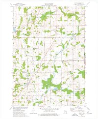
1974 Map of Batavia
USGS Topo · Published 1977About this map
Glacial topography and rural crossroads characterize this mid-1970s survey where Sheboygan, Washington, and Ozaukee counties meet. The landscape is defined by the winding course of the North Branch Milwaukee River and its confluence with Silver Creek. Small settlements like Batavia, Beechwood, and Gooseville serve as anchors for the surrounding dairy and agricultural lands, while numerous gravel pits and sandpits indicate the underlying geology of the Kettle Moraine region.
Find a feature on this map
54 named features on this map. Tap any name to fly to it.
Don’t see what you’re looking for? This feature index may not catch every label — zoom into the map to look around manually.
Map Details
Editions of this 1974 Batavia Map
This is the sole edition of this map. No revisions or reprints were ever made.
Other maps of this area

1892 · Port Washington
USGS Topo · 1:62,500

1904 · West Bend
USGS Topo · 1:62,500

1904 · Port Washington
USGS Topo · 1:62,500

1954 · Sheboygan Falls
USGS Topo · 1:62,500

1954 · Milwaukee
USGS Topo · 1:250,000

1955 · Kewaskum
USGS Topo · 1:62,500

1957 · Madison
USGS Topo · 1:250,000

1958 · Milwaukee
USGS Topo · 1:250,000

1959 · Port Washington West
USGS Topo · 1:24,000

1959 · West Bend
USGS Topo · 1:62,500