
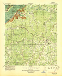
1941 Map of Batchelor
USGS Topo · Published 1944About this map
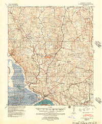
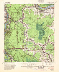
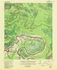
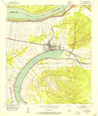
The Mississippi River and its shifting hydrology dominate this landscape at the boundary of Pointe Coupee Parish and West Feliciana Parish. The map illustrates the dramatic engineered changes to the river's course, most notably the Raccourci Cut-Off 1848 which left behind the massive loop of the Raccourci Old River. Inland, the economy of the early 1940s is anchored by the Texas and Pacific RR and large agricultural holdings like Mains Plantation and Lacour Plantation.
Find a feature on this map
107 named features on this map. Tap any name to fly to it.
Don’t see what you’re looking for? This feature index may not catch every label — zoom into the map to look around manually.
Map Details
Editions of this 1941 Batchelor Map
This is the sole edition of this map. No revisions or reprints were ever made.
Other maps of this area

1906 · Bayou Sara
USGS Topo · 1:125,000
1936 · Woodville
USGS Topo · 1:62,500
1939 · St. Francisville
USGS Topo · 1:62,500

1939 · Artonish
USGS Topo · 1:62,500
1939 · Fordoche
USGS Topo · 1:62,500
1941 · Voorhies
USGS Topo · 1:62,500
1953 · New Roads
USGS Topo · 1:24,000

1953 · Natchez
USGS Topo · 1:250,000

1954 · Artonish
USGS Topo · 1:62,500

1954 · Baton Rouge
USGS Topo · 1:250,000