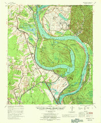
1967 Map of Batchelor
USGS Topo · Published 1969About this map
The Louisiana State Penitentiary Farm dominates the northern landscape of this Mississippi River bend, marking a site deeply intertwined with the region's agricultural and penal history. The river's dramatic evolution is visible through documented engineering shifts like Shreves Cutoff (1831) and Raccourci Cutoff (1848), which transformed the active channel and left behind oxbows like Raccourci Old River. These cutoffs isolated Raccourci Island, creating a landscape of sloughs and lakes such as Lake Killarney and Sawmill Lake.
Find a feature on this map
107 named features on this map. Tap any name to fly to it.
Don’t see what you’re looking for? This feature index may not catch every label — zoom into the map to look around manually.
Map Details
Editions of this 1967 Batchelor Map
This is the sole edition of this map. No revisions or reprints were ever made.
Other maps of this area

1906 · Bayou Sara
USGS Topo · 1:125,000

1936 · Woodville
USGS Topo · 1:62,500

1939 · St. Francisville
USGS Topo · 1:62,500

1939 · Artonish
USGS Topo · 1:62,500

1939 · Fordoche
USGS Topo · 1:62,500

1941 · Voorhies
USGS Topo · 1:62,500

1941 · Batchelor
USGS Topo · 1:62,500

1953 · New Roads
USGS Topo · 1:24,000

1953 · Natchez
USGS Topo · 1:250,000

1954 · Artonish
USGS Topo · 1:62,500