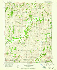
1950 Map of Bates City
USGS Topo · Published 1959About this map
The rolling hills of the Jackson Co Lafayette Co borderlands are defined by the winding course of Sni-A-Bar Creek and its many tributaries, including Seminary Branch and Horseshoe Creek. This mid-century landscape is predominantly rural, anchored by the community of Bates City and the edge of Oak Grove. The map reveals a dense network of country schools that served the farming population, such as Fish Sch, Harris Sch, and Fairview Sch.
Find a feature on this map
26 named features on this map. Tap any name to fly to it.
Don’t see what you’re looking for? This feature index may not catch every label — zoom into the map to look around manually.
Map Details
Editions of this 1950 Bates City Map
2 editions found
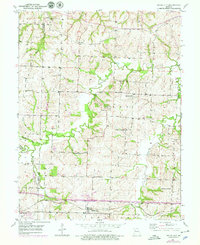
Other maps of this area

1885 · Warrensburg
USGS Topo · 1:125,000

1887 · Harrisonville
USGS Topo · 1:125,000

1887 · Warrensburg
USGS Topo · 1:125,000

1889 · Lexington
USGS Topo · 1:125,000

1892 · Harrisonville
USGS Topo · 1:125,000

1894 · Harrisonville
USGS Topo · 1:125,000

1894 · Independence
USGS Topo · 1:125,000

1894 · Warrensburg
USGS Topo · 1:125,000

1934 · Oak Grove
USGS Topo · 1:24,000

1935 · Buckner
USGS Topo · 1:24,000