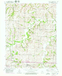
1950 Map of Bates City
USGS Topo · Published 1979About this map
Bates City sits at the southern edge of this mid-century landscape, positioned along the Gulf Mobile And Ohio railroad. The terrain is defined by the winding course of Sni-A-Bar Creek and its tributaries, including Horseshoe Creek and Tucker Branch, which carve through the undulating hills of Sni A Bar and Fort Osage townships. This 1950s survey, updated with late 1970s revisions, captures the rural character of the Jackson Co Lafayette Co border, highlighting a dense network of country schools such as Fish Sch, Fairview Sch, and Happy Hollow Sch. The distribution of these schoolhouses and small family burial grounds like Anderson Cem and Campbell Cem suggests a community structure still largely centered around localized districts. The inclusion of Foster College Sch and Pleasant Grove Sch further illustrates the historical educational footprint in this portion of Lafayette County before the consolidation of rural districts became widespread.
Find a feature on this map
20 named features on this map. Tap any name to fly to it.
Don’t see what you’re looking for? This feature index may not catch every label — zoom into the map to look around manually.
Map Details
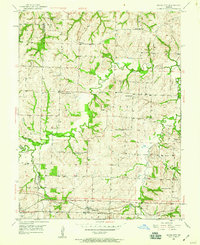
Editions of this 1950 Bates City Map
2 editions found
Other maps of this area

1885 · Warrensburg
USGS Topo · 1:125,000

1887 · Harrisonville
USGS Topo · 1:125,000

1887 · Warrensburg
USGS Topo · 1:125,000

1889 · Lexington
USGS Topo · 1:125,000

1892 · Harrisonville
USGS Topo · 1:125,000

1894 · Harrisonville
USGS Topo · 1:125,000

1894 · Independence
USGS Topo · 1:125,000

1894 · Warrensburg
USGS Topo · 1:125,000

1934 · Oak Grove
USGS Topo · 1:24,000

1935 · Buckner
USGS Topo · 1:24,000