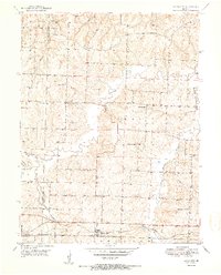
1951 Map of Bates City
USGS Topo · Published 1951About this map
The Gulf Mobile and Ohio railroad corridor anchors the southern portion of this mid-century landscape, linking the growing community of Bates City with nearby Oak Grove at the Jackson and Lafayette county line. The rural character of the area is defined by a dense network of country schools and family-linked cemeteries, reflecting a deeply established farming community. Educational landmarks like Foster College Sch and Ish Sch are distributed across the terrain, serving the population located between the winding Sni-A-Bar Creek and its various tributaries.
Find a feature on this map
24 named features on this map. Tap any name to fly to it.
Don’t see what you’re looking for? This feature index may not catch every label — zoom into the map to look around manually.
Map Details
Editions of this 1951 Bates City Map
2 editions found
Other maps of this area

1885 · Warrensburg
USGS Topo · 1:125,000

1887 · Harrisonville
USGS Topo · 1:125,000

1887 · Warrensburg
USGS Topo · 1:125,000

1889 · Lexington
USGS Topo · 1:125,000

1892 · Harrisonville
USGS Topo · 1:125,000

1894 · Harrisonville
USGS Topo · 1:125,000

1894 · Independence
USGS Topo · 1:125,000

1894 · Warrensburg
USGS Topo · 1:125,000

1934 · Oak Grove
USGS Topo · 1:24,000

1935 · Buckner
USGS Topo · 1:24,000