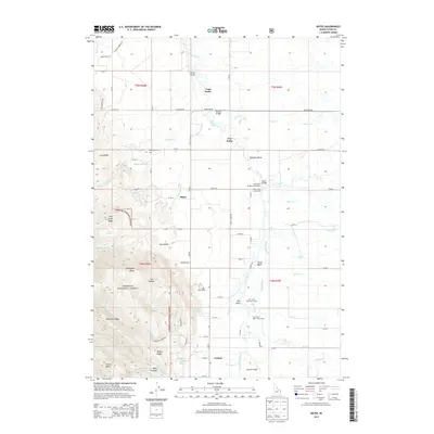
2013 Map of Bates
USGS Topo · Published 2013About this map
Bates and Cedron anchor this Idaho valley landscape, situated along the eastern edge of the Targhee National Forest. The Teton River winds prominently through the center of the sheet, defined by significant meanders like Rainbow Bend and Big Bend. The transition from the high, ridged terrain of Mahogany Ridge and Patterson Ridge in the west to the alluvial floor of the Teton Basin in the east highlights the region's diverse topography.
Find a feature on this map
80 named features on this map. Tap any name to fly to it.
Don’t see what you’re looking for? This feature index may not catch every label — zoom into the map to look around manually.
Map Details
Editions of this 2013 Bates Map
This is the sole edition of this map. No revisions or reprints were ever made.
Other maps of this area

1943 · Driggs
USGS Topo · 1:62,500

1943 · Garns Mtn
USGS Topo · 1:62,500

1946 · Driggs
USGS Topo · 1:62,500

1946 · Garns Mtn
USGS Topo · 1:62,500

1955 · Driggs
USGS Topo · 1:250,000

1958 · Driggs
USGS Topo · 1:250,000

1962 · Driggs
USGS Topo · 1:250,000

1965 · Packsaddle Lake
USGS Topo · 1:24,000

1965 · Clawson
USGS Topo · 1:24,000
1965 · Tetonia
USGS Topo · 1:24,000