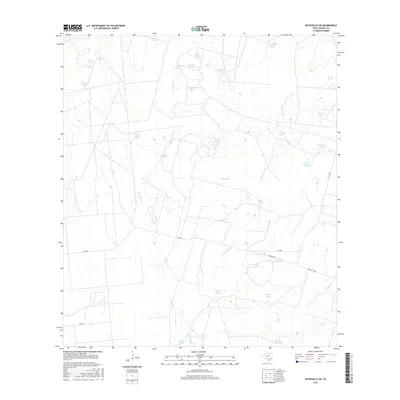
2016 Map of Batesville SW
USGS Topo · Published 2016About this map
Tortuga Cr and its eastern branch, the E Br Tortuga Cr, define the drainage patterns across this section of Zavala County. The landscape is heavily characterized by its ranching infrastructure, dotted with numerous water tanks named for local landmarks or families, such as Cassin Tank, Lost Waterhole Tank, and Headquarters Tank. These water sources are vital features in an arid environment where ranch roads like Ranch Rd 1867 and FM 1025 provide the primary transit corridors between properties.
Find a feature on this map
30 named features on this map. Tap any name to fly to it.
Don’t see what you’re looking for? This feature index may not catch every label — zoom into the map to look around manually.
Map Details
Editions of this 2016 Batesville SW Map
This is the sole edition of this map. No revisions or reprints were ever made.
Other maps of this area

1939 · Carrizo Springs
USGS Topo · 1:62,500

1939 · Big Wells
USGS Topo · 1:62,500

1939 · La Pryor
USGS Topo · 1:62,500

1953 · Crystal City
USGS Topo · 1:250,000

1955 · Crystal City
USGS Topo · 1:250,000

1957 · Batesville
USGS Topo · 1:62,500

1961 · Crystal City
USGS Topo · 1:250,000

1968 · Crystal City
USGS Topo · 1:250,000
1972 · Batesville
USGS Topo · 1:24,000
1972 · Batesville SW
USGS Topo · 1:24,000