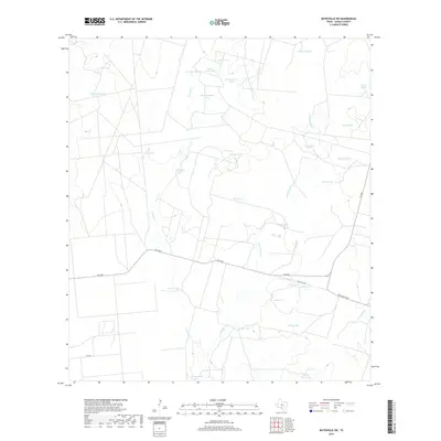
2019 Map of Batesville SW
USGS Topo · Published 2019About this map
The brush country of Zavala County is defined by a complex network of ephemeral drainage and livestock infrastructure, centered on the winding Tortuga Cr. This landscape, characterized by arid ranching conditions, relies on numerous tanks to manage water across the territory. Notable water features include Silver Lake Tank and Lost Waterhole Tank in the north, while the southern reaches are marked by Badger Hole Tank and the drainage of Arroyo Negro.
Find a feature on this map
29 named features on this map. Tap any name to fly to it.
Don’t see what you’re looking for? This feature index may not catch every label — zoom into the map to look around manually.
Map Details
Editions of this 2019 Batesville SW Map
This is the sole edition of this map. No revisions or reprints were ever made.
Other maps of this area

1939 · Carrizo Springs
USGS Topo · 1:62,500

1939 · Big Wells
USGS Topo · 1:62,500

1939 · La Pryor
USGS Topo · 1:62,500

1953 · Crystal City
USGS Topo · 1:250,000

1955 · Crystal City
USGS Topo · 1:250,000

1957 · Batesville
USGS Topo · 1:62,500

1961 · Crystal City
USGS Topo · 1:250,000

1968 · Crystal City
USGS Topo · 1:250,000
1972 · Batesville
USGS Topo · 1:24,000
1972 · Batesville SW
USGS Topo · 1:24,000