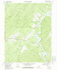
1968 Map of Bath Alum
USGS Topo · Published 1986About this map
Cowpasture River winds through the eastern portion of this terrain, following a series of tight bends defined by the surrounding ridges. The settlement at Bath Alum serves as a local crossroads near the confluence of Thompson Creek and Cowpasture River, while the smaller community of McClung sits further north along the slopes of McClung Ridge. The landscape is dominated by the massive presence of the George Washington National Forest, covering prominent heights like Warm Springs Mountain and Big Piney Mountain. Local history is anchored by rural institutions such as Westminister Chapel Cem and Woodland Ch Cem. Significant landmarks like Chimney Rocks and a designated Landing Strip near Jordan Run highlight the intersection of natural geologic features and mid-century rural infrastructure.
Find a feature on this map
63 named features on this map. Tap any name to fly to it.
Don’t see what you’re looking for? This feature index may not catch every label — zoom into the map to look around manually.
Map Details
Editions of this 1968 Bath Alum Map
Other maps of this area

1894 · Natural Bridge
USGS Topo · 1:125,000

1901 · Monterey
USGS Topo · 1:125,000

1923 · Warm Springs
USGS Topo · 1:48,000

1926 · Warm Springs
USGS Topo · 1:62,500

1930 · Warm Springs Run
USGS Topo · 1:24,000

1931 · Healing Springs
USGS Topo · 1:24,000

1933 · Warm Springs Run
USGS Topo · 1:31,680

1933 · Healing Springs
USGS Topo · 1:31,680

1945 · Clifton Forge
USGS Topo · 1:62,500

1946 · Millboro
USGS Topo · 1:62,500