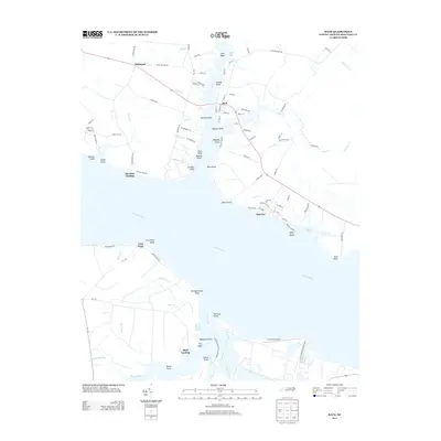
2013 Map of Bath
USGS Topo · Published 2013About this map
The Bath settlement sits prominently where Bath Cr meets the wide expanse of the Pamlico River, reflecting its deep coastal history. This landscape is defined by its intricate shoreline of guts, coves, and points, including Bonners Point, Catnip Point, and Respess Shore. Across the river, the industrial footprint of the Texasgulf Phosphate Operation contrasts with the quiet residential patterns of Bayview and Shell Landing. The map reveals a community deeply tied to the water, with numerous landings like Hawkins Landing and Core Point serving as gateways to the sound. Aviation and industry also shape the southern bank near Lee Creek Airport, while the northern interior toward Whitepost transitions into a network of creek drainages such as Adams Cr and Boyd Cr. The presence of large-scale mineral extraction alongside centuries-old maritime settlements provides a clear picture of the modern economy intersecting with the region's traditional seafaring roots.
Find a feature on this map
110 named features on this map. Tap any name to fly to it.
Don’t see what you’re looking for? This feature index may not catch every label — zoom into the map to look around manually.
Map Details
Editions of this 2013 Bath Map
This is the sole edition of this map. No revisions or reprints were ever made.
Other maps of this area

1914 · Belhaven
USGS Topo · 1:48,000

1916 · Belhaven
USGS Topo · 1:62,500

1943 · Plymouth
USGS Topo · 1:125,000

1950 · South Creek
USGS Topo · 1:24,000

1950 · Pinetown
USGS Topo · 1:24,000

1950 · Aurora
USGS Topo · 1:24,000

1950 · Edward
USGS Topo · 1:24,000

1951 · Bunyan
USGS Topo · 1:24,000

1951 · Bath
USGS Topo · 1:24,000

1951 · Ransomville
USGS Topo · 1:24,000