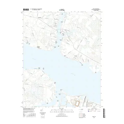
2016 Map of Bath
USGS Topo · Published 2016About this map
Bath and the surrounding Beaufort County coastline are defined by the deep inlets and points along the Pamlico River. As North Carolina's oldest incorporated town, the area's geography is steeped in maritime lore, evidenced by names like Teachs Gut and Teachs CV, reflecting the historical presence of Edward Teach. The landscape transitions from the residential clusters at Bayview and Hawkins Landing to the extensive wetlands of Rumley Marsh and Culter Sloughs.
Find a feature on this map
101 named features on this map. Tap any name to fly to it.
Don’t see what you’re looking for? This feature index may not catch every label — zoom into the map to look around manually.
Map Details
Editions of this 2016 Bath Map
This is the sole edition of this map. No revisions or reprints were ever made.
Other maps of this area

1914 · Belhaven
USGS Topo · 1:48,000

1916 · Belhaven
USGS Topo · 1:62,500

1943 · Plymouth
USGS Topo · 1:125,000

1950 · South Creek
USGS Topo · 1:24,000

1950 · Pinetown
USGS Topo · 1:24,000

1950 · Aurora
USGS Topo · 1:24,000

1950 · Edward
USGS Topo · 1:24,000

1951 · Bunyan
USGS Topo · 1:24,000

1951 · Bath
USGS Topo · 1:24,000

1951 · Ransomville
USGS Topo · 1:24,000