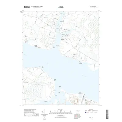
2019 Map of Bath
USGS Topo · Published 2019About this map
Bath sits at the center of this coastal landscape, occupying the peninsula between Bath Creek and Back Creek. This 2019 survey documents a shoreline defined by intricate points and tidal guts, where the Pamlico River divides the northern settlements of Bayview and Hawkins Landing from the southern reaches of Core Point. The topography reveals a history of land use tied to these waterways, with names like Brick House Cove and Crawford Mill Run suggesting early coastal industry and habitation.
Find a feature on this map
109 named features on this map. Tap any name to fly to it.
Don’t see what you’re looking for? This feature index may not catch every label — zoom into the map to look around manually.
Map Details
Editions of this 2019 Bath Map
This is the sole edition of this map. No revisions or reprints were ever made.
Other maps of this area

1914 · Belhaven
USGS Topo · 1:48,000

1916 · Belhaven
USGS Topo · 1:62,500

1943 · Plymouth
USGS Topo · 1:125,000

1950 · South Creek
USGS Topo · 1:24,000

1950 · Pinetown
USGS Topo · 1:24,000

1950 · Aurora
USGS Topo · 1:24,000

1950 · Edward
USGS Topo · 1:24,000

1951 · Bunyan
USGS Topo · 1:24,000

1951 · Bath
USGS Topo · 1:24,000

1951 · Ransomville
USGS Topo · 1:24,000