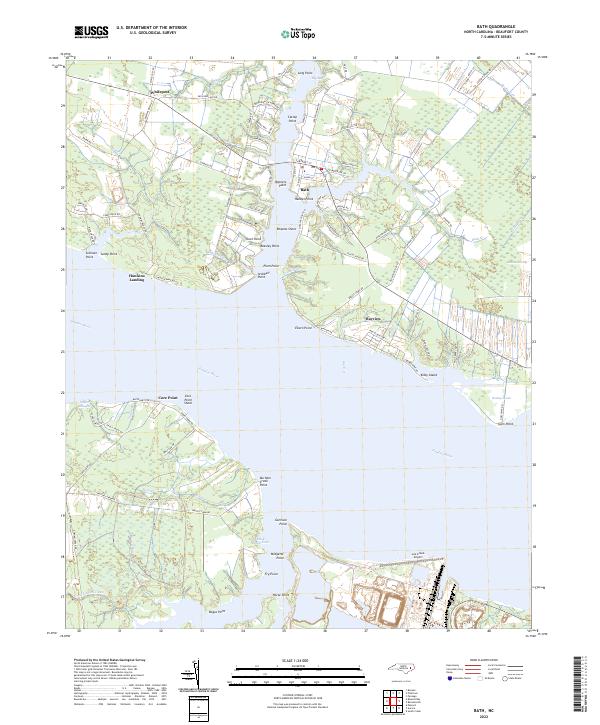
2022 Map of Bath
USGS Topo · Published 2022About this map
The Bath township occupies a prominent position on the northern shore of the Pamlico River, where the landscape is defined by a series of deep tidal inlets including Back Cr and Adams Cr. The historic settlement pattern remains focused on the water, with Teachs Gut and Archbell Gut cutting into the coastline near Handys Point and Bonners Point. This 2022 survey illustrates the coastal geography of Beaufort County, showing the proximity of the Lee Creek Airport to the southern bank and the marshy expanses of Rumley Marsh and Jackson Swamp. Further inland, small communities like Whitepost and Bayview are connected by a network of local roads such as Camp Leach Rd and Slade Farm Rd. The map also reveals the maritime importance of locations like Core Point and Hawkins Landing, which serve as key markers along the broad estuary.
Find a feature on this map
101 named features on this map. Tap any name to fly to it.
Don’t see what you’re looking for? This feature index may not catch every label — zoom into the map to look around manually.
Map Details
Editions of this 2022 Bath Map
This is the sole edition of this map. No revisions or reprints were ever made.
Other maps of this area

1914 · Belhaven
USGS Topo · 1:48,000

1916 · Belhaven
USGS Topo · 1:62,500

1943 · Plymouth
USGS Topo · 1:125,000

1950 · South Creek
USGS Topo · 1:24,000

1950 · Pinetown
USGS Topo · 1:24,000

1950 · Aurora
USGS Topo · 1:24,000

1950 · Edward
USGS Topo · 1:24,000

1951 · Bunyan
USGS Topo · 1:24,000

1951 · Bath
USGS Topo · 1:24,000

1951 · Ransomville
USGS Topo · 1:24,000