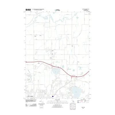
2011 Map of Bath
USGS Topo · Published 2011About this map
Bath and the northern reaches of East Lansing define this landscape just after the first decade of the 2000s, characterized by a transition from suburban development to rural acreage. The southern portion of the map is densely marked by the residential patterns and recreational spaces of the university community, including the Falcon Golf Course and University Airpark. Moving north toward the Bath community center, the terrain opens into a series of significant water bodies and wetland systems, most notably Lake Lansing and Park Lake.
Find a feature on this map
79 named features on this map. Tap any name to fly to it.
Don’t see what you’re looking for? This feature index may not catch every label — zoom into the map to look around manually.
Map Details
Editions of this 2011 Bath Map
This is the sole edition of this map. No revisions or reprints were ever made.
Other maps of this area

1909 · Mason
USGS Topo · 1:62,500

1910 · Lansing
USGS Topo · 1:62,500

1911 · Mason
USGS Topo · 1:62,500

1912 · Lansing
USGS Topo · 1:62,500

1927 · De Witt
USGS Topo · 1:62,500

1928 · Laingsburg
USGS Topo · 1:62,500

1944 · Laingsburg
USGS Topo · 1:62,500

1958 · Grand Rapids
USGS Topo · 1:250,000

1961 · Grand Rapids
USGS Topo · 1:250,000

1962 · Grand Rapids
USGS Topo · 1:250,000
Featured Places
- East Lansing, MI
- Victor Township, MI
- Olive Township, MI
- DeWitt Charter Township, MI
- Bath Charter Township, MI