
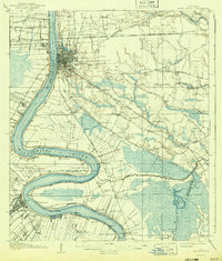
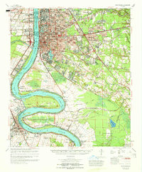
1954 Map of Baton Rouge
USGS Topo · Published 1974This historical map portrays the area of Baton Rouge in 1954, primarily covering East Baton Rouge Parish as well as portions of Mississippi. Featuring a scale of 1:250000, this map provides a highly detailed snapshot of the terrain, roads, buildings, counties, and historical landmarks in the Baton Rouge region at the time. Published in 1974, it is one of 2 known editions of this map due to revisions or reprints.
Find a feature on this map
257 named features on this map. Tap any name to fly to it.
Don’t see what you’re looking for? This feature index may not catch every label — zoom into the map to look around manually.
Map Details
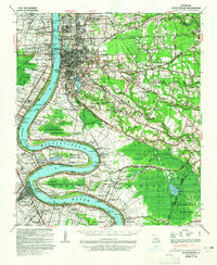
Editions of this 1954 Baton Rouge Map
2 editions found
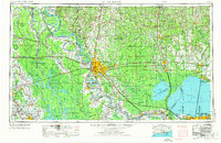
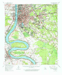
Historical Maps of Angola Landing Through Time
9 maps found
1908 Baton Rouge
East Baton Rouge Parish, LA
1939 Baton Rouge
East Baton Rouge Parish, LA
1954 Baton Rouge
East Baton Rouge Parish, LA

1956 Baton Rouge
East Baton Rouge Parish, LA

1961 Baton Rouge
East Baton Rouge Parish, LA

1962 Baton Rouge
East Baton Rouge Parish, LA
1963 Baton Rouge
East Baton Rouge Parish, LA
1965 Baton Rouge
East Baton Rouge Parish, LA

1984 Baton Rouge
East Baton Rouge Parish, LA