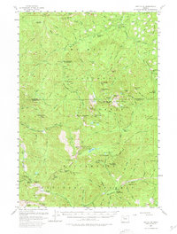
1956 Map of Battle Ax
USGS Topo · Published 1980About this map
Mount Hood National Forest and Willamette National Forest converge in this mid-century survey, revealing a landscape defined by fire lookouts and high-elevation waters. The peak of Battle Ax dominates the central terrain, supported by a network of fire detection points including the Thunder Mtn Lookout and Basin Lookout. This era shows the infrastructure of remote forest management, from the Bagby Hot Springs Guard Station to several backcountry refuges like the Alder Swamp Shelter and Rocky Top Shelter.
Find a feature on this map
108 named features on this map. Tap any name to fly to it.
Don’t see what you’re looking for? This feature index may not catch every label — zoom into the map to look around manually.
Map Details
Editions of this 1956 Battle Ax Map
4 editions found

Other maps of this area

1916 · Estacada
USGS Topo · 1:125,000

1924 · Mount Hood
USGS Topo · 1:125,000

1927 · Mount Hood
USGS Topo · 1:125,000

1927 · Mt. Jefferson
USGS Topo · 1:125,000

1929 · Mill City
USGS Topo · 1:125,000

1930 · Mt. Jefferson
USGS Topo · 1:125,000

1948 · Vancouver
USGS Topo · 1:250,000

1950 · Vancouver
USGS Topo · 1:250,000

1950 · Vancouver
USGS Topo · 1:250,000

1953 · Salem
USGS Topo · 1:250,000