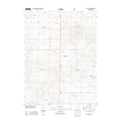
2013 Map of Battle Canyon
USGS Topo · Published 2013About this map
Pawnee National Grassland dominates the landscape in this high plains region of Weld County, where the topography is defined by the sharp descent into Battle Canyon and the winding course of Twomile Creek. This modern survey reveals a landscape largely dedicated to conservation and grazing, punctuated by vital water infrastructure in an arid environment. The presence of the Baker Windmill and Two Mile Windmill alongside the Uhl Reservoir indicates the ongoing importance of water management for local agriculture and livestock. A grid of county roads, such as Co Road 138 and State Hwy 71, provides access to this expansive terrain, while geographic features like Sidney Draw and Cedar Creek offer insights into the natural drainage patterns of the Colorado prairie.
Find a feature on this map
33 named features on this map. Tap any name to fly to it.
Don’t see what you’re looking for? This feature index may not catch every label — zoom into the map to look around manually.
Map Details
Editions of this 2013 Battle Canyon Map
This is the sole edition of this map. No revisions or reprints were ever made.
Other maps of this area

1954 · Sterling
USGS Topo · 1:250,000

1954 · Scottsbluff
USGS Topo · 1:250,000

1958 · Scottsbluff
USGS Topo · 1:250,000

1958 · Sterling
USGS Topo · 1:250,000

1972 · Kimball SE
USGS Topo · 1:24,000

1972 · Kimball SW
USGS Topo · 1:24,000

1972 · Bushnell SE
USGS Topo · 1:24,000

1977 · Dipper Spring
USGS Topo · 1:24,000
1977 · Vim School
USGS Topo · 1:24,000
1977 · Gatehook Spring
USGS Topo · 1:24,000