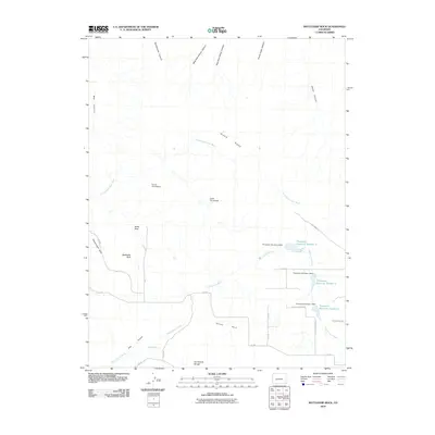
2010 Map of Battleship Rock
USGS Topo · Published 2010About this map
Glade Park occupies the lower southern portion of this high-desert plateau, where drainage networks like Trail Canyon Wash and Clark Wash carve through the landscape toward the north. The area's ranching and settlement history is anchored by family sites such as the Parrish Homestead and Leslie Homestead, located near the high point of Black Ridge. To the east, a sequence of water management features including Thompson Reservoir Number 3, Thompson Reservoir Number 2, and Thompson Reservoir Number 1 demonstrate the critical importance of water storage in this arid environment.
Find a feature on this map
36 named features on this map. Tap any name to fly to it.
Don’t see what you’re looking for? This feature index may not catch every label — zoom into the map to look around manually.
Map Details
Editions of this 2010 Battleship Rock Map
This is the sole edition of this map. No revisions or reprints were ever made.
Other maps of this area

1934 · Colorado National Monument
USGS Topo · 1:24,000

1956 · Moab
USGS Topo · 1:250,000

1956 · Grand Junction
USGS Topo · 1:250,000

1959 · Grand Junction
USGS Topo · 1:250,000

1959 · Moab
USGS Topo · 1:250,000

1960 · Moab
USGS Topo · 1:250,000

1960 · Grand Junction
USGS Topo · 1:250,000

1962 · Moab
USGS Topo · 1:250,000

1962 · Grand Junction
USGS Topo · 1:250,000

1962 · Fruita
USGS Topo · 1:24,000