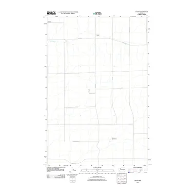
2011 Map of Batum
USGS Topo · Published 2011About this map
Batum sits at the heart of this rural landscape in Adams County, where a strictly organized grid of agricultural roads defines the terrain. The presence of the Titan Missile Silo near N Batum Rd provides a striking reminder of Cold War defense infrastructure integrated into the eastern Washington wheat country. This landscape is largely defined by its sparse settlement and functional transit routes like Tokio Rd W and Griffith Rd W. Local heritage is anchored by the Ammaus Cemetery in the northwest, while the Tree Heart Ranch Airport and the natural water source at Rock Spring illustrate the intersection of private aviation and the vital role of water in this semi-arid region.
Find a feature on this map
17 named features on this map. Tap any name to fly to it.
Don’t see what you’re looking for? This feature index may not catch every label — zoom into the map to look around manually.
Map Details
Editions of this 2011 Batum Map
This is the sole edition of this map. No revisions or reprints were ever made.
Other maps of this area

1925 · Schrag
USGS Topo · 1:62,500

1953 · Ritzville
USGS Topo · 1:250,000

1959 · Ritzville
USGS Topo · 1:250,000

1965 · Ritzville
USGS Topo · 1:250,000

1967 · Reiman SW
USGS Topo · 1:24,000
1967 · Ruff
USGS Topo · 1:24,000

1967 · Batum
USGS Topo · 1:24,000
1967 · Weber
USGS Topo · 1:24,000

1967 · Reiman
USGS Topo · 1:24,000
1967 · Schrag
USGS Topo · 1:24,000