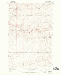
1967 Map of Schrag
USGS Topo · Published 1970About this map
Bauer Coulee and Farrier Coulee define the topography of this central Washington landscape, where the Northern Pacific railway cuts through the settlement of Schrag. The late 1960s environment is primarily agricultural, marked by a systematic grid of family-named thoroughfares including Franz Road, Leisle Road, and Batum Road. Evidence of localized infrastructure is found at the Grain Elevator and a dedicated Landing Strip, while the mention of Mennonite at a hilltop site near Weber Road suggests specific communal roots. This survey captures the transition of the region's dryland farming and transportation networks, illustrated by the various gravel and borrow pits that supported the development of the rural road system across the Adams County line.
Find a feature on this map
23 named features on this map. Tap any name to fly to it.
Don’t see what you’re looking for? This feature index may not catch every label — zoom into the map to look around manually.
Map Details
Editions of this 1967 Schrag Map
2 editions found
Other maps of this area

1916 · Connell
USGS Topo · 1:125,000

1918 · Connell
USGS Topo · 1:125,000

1925 · Schrag
USGS Topo · 1:62,500

1953 · Walla Walla
USGS Topo · 1:250,000

1953 · Ritzville
USGS Topo · 1:250,000

1958 · Walla Walla
USGS Topo · 1:250,000

1959 · Ritzville
USGS Topo · 1:250,000

1965 · Ritzville
USGS Topo · 1:250,000

1967 · Reiman SW
USGS Topo · 1:24,000
1967 · Ruff
USGS Topo · 1:24,000