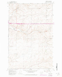
1967 Map of Schrag
USGS Topo · Published 1982About this map
Schrag serves as a central hub in this agricultural landscape, situated where the Burlington Northern line cuts through the coulee-scarred terrain of Adams County. The map reveals a highly structured grid of farm-to-market roads, many bearing family names that indicate the German-Russian heritage of the region's homesteaders, such as Franz Road, Leisle Road, and Gering Road. This 1960s-era topography, with later 1970s updates, captures the intersection of industrial rail transport and early interstate infrastructure, evidenced by the Rest Areas and Grain Elevator that supported the local wheat economy.
Find a feature on this map
20 named features on this map. Tap any name to fly to it.
Don’t see what you’re looking for? This feature index may not catch every label — zoom into the map to look around manually.
Map Details
Editions of this 1967 Schrag Map
2 editions found
Other maps of this area

1916 · Connell
USGS Topo · 1:125,000

1918 · Connell
USGS Topo · 1:125,000

1925 · Schrag
USGS Topo · 1:62,500

1953 · Walla Walla
USGS Topo · 1:250,000

1953 · Ritzville
USGS Topo · 1:250,000

1958 · Walla Walla
USGS Topo · 1:250,000

1959 · Ritzville
USGS Topo · 1:250,000

1965 · Ritzville
USGS Topo · 1:250,000

1967 · Reiman SW
USGS Topo · 1:24,000
1967 · Ruff
USGS Topo · 1:24,000