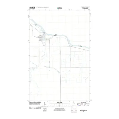
2010 Map of Baudette
USGS Topo · Published 2010About this map
Baudette sits at the international threshold between the United States and Canada, defined by its position where the Baudette River joins the much larger Rainy River. This 2010 survey illustrates the town's role as a border crossing, anchored by the Baudette International Bridge and the Baudette International Airport just to the north. The local geography is shaped by water and transit, with a dense network of county roads extending into the surrounding rural sections. Cultural landmarks like the Lake of the Woods County Fairgrounds and the Baudette Post Office mark the civic heart of the community, while the Elm Park Cemetery and Baudette Rest Area provide quiet points of interest along the riverbanks. The map captures the settlement's layout before more recent infrastructure changes, preserving the spatial relationship between the town's residential streets and the primary waterways that dictate the region's boundary lines.
Find a feature on this map
20 named features on this map. Tap any name to fly to it.
Don’t see what you’re looking for? This feature index may not catch every label — zoom into the map to look around manually.
Map Details
Editions of this 2010 Baudette Map
This is the sole edition of this map. No revisions or reprints were ever made.
Other maps of this area

1919 · Canada
USGS Topo · 1:62,500

1921 · Baudette
USGS Topo · 1:62,500

1954 · Roseau
USGS Topo · 1:250,000

1957 · Roseau
USGS Topo · 1:250,000

1958 · Roseau
USGS Topo · 1:250,000
1967 · Wheelers Point
USGS Topo · 1:24,000

1968 · Baudette SE
USGS Topo · 1:24,000

1968 · Clementson
USGS Topo · 1:24,000

1968 · Clementson SW
USGS Topo · 1:24,000
1968 · Baudette SW
USGS Topo · 1:24,000