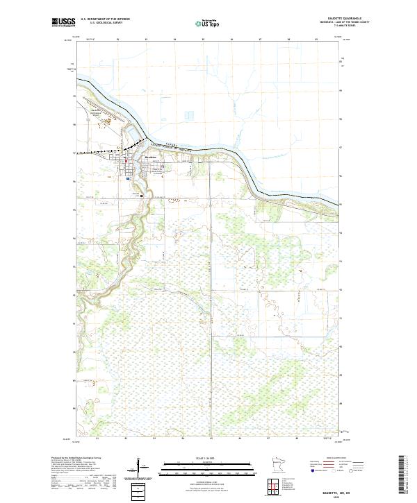
2022 Map of Baudette
USGS Topo · Published 2022About this map
Rainy River forms the international boundary with Canada, defining the northern edge of this Minnesota landscape. The city of Baudette serves as the focal point, positioned at the confluence of the Baudette River and the larger international waterway. This 2022 survey captures the modern layout of the county seat, where the Lake of the Woods County Courthouse and Baudette International Airport stand as primary civic landmarks. South of the city center, the terrain transitions into a mosaic of wetlands and stream networks, including Miller's Creek and the Kaunamaekauk River. Local history and genealogy are represented by Elm Park Cem, situated just west of the river junction. The road network, including Main St and Co St Aid Hwy 35, reveals how the settlement pattern remains closely tied to the water's edge before moving into the interior sections of t160n r31w.
Find a feature on this map
48 named features on this map. Tap any name to fly to it.
Don’t see what you’re looking for? This feature index may not catch every label — zoom into the map to look around manually.
Map Details
Editions of this 2022 Baudette Map
This is the sole edition of this map. No revisions or reprints were ever made.
Other maps of this area

1919 · Canada
USGS Topo · 1:62,500

1921 · Baudette
USGS Topo · 1:62,500

1954 · Roseau
USGS Topo · 1:250,000

1957 · Roseau
USGS Topo · 1:250,000

1958 · Roseau
USGS Topo · 1:250,000
1967 · Wheelers Point
USGS Topo · 1:24,000

1968 · Baudette SE
USGS Topo · 1:24,000

1968 · Clementson
USGS Topo · 1:24,000

1968 · Clementson SW
USGS Topo · 1:24,000
1968 · Baudette SW
USGS Topo · 1:24,000