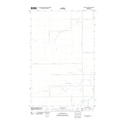
2010 Map of Baudette SW
USGS Topo · Published 2010About this map
Carp serves as the primary focal point in this sparsely settled region of Lake of the Woods County, situated near the confluence of the Rapid River and its northern tributary. The landscape is defined by a dense network of watercourses and section-line roads, illustrating the organized survey grid of northern Minnesota. The North Branch Rapid River meanders through the southern portion of the quadrangle, while the Baudette River and Kualnes Creek drain the northern reaches. Much of the activity here is concentrated along County Hwy-1 and Bankton Trl, providing a clear view of the rural transit patterns and small-scale settlement layout in the early twenty-first century. This topographical record reflects the quiet, water-rich environment of the borderlands before further modernization or changes in land use occurred.
Find a feature on this map
15 named features on this map. Tap any name to fly to it.
Don’t see what you’re looking for? This feature index may not catch every label — zoom into the map to look around manually.
Map Details
Editions of this 2010 Baudette SW Map
This is the sole edition of this map. No revisions or reprints were ever made.
Other maps of this area

1919 · Peppermint Creek
USGS Topo · 1:62,500

1919 · G
USGS Topo · 1:62,500

1919 · Knutson
USGS Topo · 1:62,500

1921 · Baudette
USGS Topo · 1:62,500

1943 · Peppermint Creek
USGS Topo · 1:62,500

1954 · Roseau
USGS Topo · 1:250,000

1957 · Roseau
USGS Topo · 1:250,000

1958 · Roseau
USGS Topo · 1:250,000

1968 · Baudette SE
USGS Topo · 1:24,000
1968 · Graceton SE
USGS Topo · 1:24,000