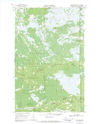
1968 Map of Graceton SE
USGS Topo · Published 1970About this map
The Red Lake Indian Reservation and Beltrami Island State Forest converge in this northern Minnesota landscape, where the terrain is defined by complex seasonal drainage patterns and sparse human infrastructure. Most navigation in the late 1960s relied on the Winter Trail and Pitt Grade, indicating a region where accessibility was largely dictated by the freeze.
Find a feature on this map
12 named features on this map. Tap any name to fly to it.
Don’t see what you’re looking for? This feature index may not catch every label — zoom into the map to look around manually.
Map Details
Editions of this 1968 Graceton SE Map
This is the sole edition of this map. No revisions or reprints were ever made.
Other maps of this area

1919 · Peppermint Creek
USGS Topo · 1:62,500

1919 · G
USGS Topo · 1:62,500

1919 · Knutson
USGS Topo · 1:62,500

1921 · Baudette
USGS Topo · 1:62,500

1943 · Peppermint Creek
USGS Topo · 1:62,500

1954 · Roseau
USGS Topo · 1:250,000

1957 · Roseau
USGS Topo · 1:250,000

1958 · Roseau
USGS Topo · 1:250,000
1968 · Baudette SW
USGS Topo · 1:24,000
1968 · Graceton NW
USGS Topo · 1:24,000