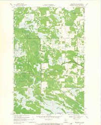
1968 Map of Graceton NW
USGS Topo · Published 1971About this map
Beltrami Island State Forest defines the character of this northern Minnesota landscape, where extensive wetlands and dense forest cover dominate the terrain. The northern reaches of the Red Lake Indian Reservation intersect with state-managed lands, creating a complex administrative boundary that shaped land use in the late 1960s. The Winter Road River meanders across the central portion of the map, providing a vital drainage network for the surrounding peatlands. Human activity is largely confined to a few rugged routes such as Krull Trail and Winter Road Trail, which suggest a seasonal economy or timber access rather than permanent settlement. Small-scale resource extraction is evidenced by a Gravel Pit located near the forest boundaries, serving as a rare marker of industrial development in an otherwise primitive wilderness.
Find a feature on this map
8 named features on this map. Tap any name to fly to it.
Don’t see what you’re looking for? This feature index may not catch every label — zoom into the map to look around manually.
Map Details
Editions of this 1968 Graceton NW Map
This is the sole edition of this map. No revisions or reprints were ever made.
Other maps of this area

1918 · Winterroad
USGS Topo · 1:62,500

1918 · Roosevelt
USGS Topo · 1:62,500

1918 · Williams
USGS Topo · 1:62,500

1919 · Peppermint Creek
USGS Topo · 1:62,500

1943 · Peppermint Creek
USGS Topo · 1:62,500

1943 · Roosevelt
USGS Topo · 1:62,500

1954 · Roseau
USGS Topo · 1:250,000

1957 · Roseau
USGS Topo · 1:250,000

1958 · Roseau
USGS Topo · 1:250,000

1967 · Williams
USGS Topo · 1:24,000