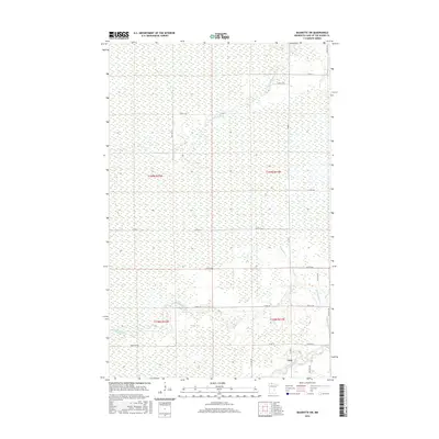
2016 Map of Baudette SW
USGS Topo · Published 2016About this map
Carp sits at the junction of Co Hwy 1 and Co Rd 16 in a landscape dominated by the extensive wetlands of northern Minnesota. This area is defined by its complex drainage network, where the Rapid River and its tributary, the N Br Rapid River, wind through the southern sections. To the north, the Baudette River and Kujanes Cr navigate the saturated terrain. The map reveals a strictly regulated grid of section lines and rural routes, such as Co Rd 5 and Bankton Trl, which navigate the mire. The density of wetland symbols across the entire quadrangle indicates a wilderness character where development is sparse and limited to the periphery of these river systems.
Find a feature on this map
27 named features on this map. Tap any name to fly to it.
Don’t see what you’re looking for? This feature index may not catch every label — zoom into the map to look around manually.
Map Details
Editions of this 2016 Baudette SW Map
This is the sole edition of this map. No revisions or reprints were ever made.
Other maps of this area

1919 · Peppermint Creek
USGS Topo · 1:62,500

1919 · G
USGS Topo · 1:62,500

1919 · Knutson
USGS Topo · 1:62,500

1921 · Baudette
USGS Topo · 1:62,500

1943 · Peppermint Creek
USGS Topo · 1:62,500

1954 · Roseau
USGS Topo · 1:250,000

1957 · Roseau
USGS Topo · 1:250,000

1958 · Roseau
USGS Topo · 1:250,000

1968 · Baudette SE
USGS Topo · 1:24,000
1968 · Graceton SE
USGS Topo · 1:24,000