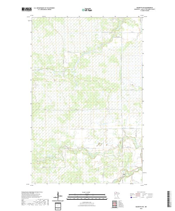
2022 Map of Baudette SW
USGS Topo · Published 2022About this map
The small settlement of Carp serves as the primary landmark in this wetland-rich region of Lake of the Woods County. The landscape is defined by the convergence of the Rapid River and the N Br Rapid River, where the terrain transitions into a dense network of watercourses and marshland typical of northern Minnesota. A local transportation network of section-line roads, including Co Rd 146 and Co Rd 87, provides access through the low-lying interior, while the Bankton Trl skirts the southwestern reaches. The map detail highlights the winding path of the Baudette River and its tributary Kvalnes Cr as they drain northward, illustrating the natural drainage patterns that have dictated the region's scattered development and rural road system in the modern era.
Find a feature on this map
27 named features on this map. Tap any name to fly to it.
Don’t see what you’re looking for? This feature index may not catch every label — zoom into the map to look around manually.
Map Details
Editions of this 2022 Baudette SW Map
This is the sole edition of this map. No revisions or reprints were ever made.
Other maps of this area

1919 · Peppermint Creek
USGS Topo · 1:62,500

1919 · G
USGS Topo · 1:62,500

1919 · Knutson
USGS Topo · 1:62,500

1921 · Baudette
USGS Topo · 1:62,500

1943 · Peppermint Creek
USGS Topo · 1:62,500

1954 · Roseau
USGS Topo · 1:250,000

1957 · Roseau
USGS Topo · 1:250,000

1958 · Roseau
USGS Topo · 1:250,000

1968 · Baudette SE
USGS Topo · 1:24,000
1968 · Graceton SE
USGS Topo · 1:24,000