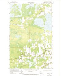
1968 Map of Baudette SW
USGS Topo · Published 1970About this map
The Red Lake Indian Reservation dominates this northern Minnesota landscape, where the confluence of the Rapid River and the North Branch Rapid River defines the local drainage patterns. The terrain is characterized by extensive wetlands and seasonal access routes, marked by numerous Winter Trails and the Bankton Trail that cut through the wooded sections. Small pockets of community life are visible near the rivers, notably at the Carp Chapel and a nearby Lookout Tower, which likely served as a vital fire observation post for the surrounding timberlands. The Baudette River meanders through the northern reaches, while Kralnes Creek feeds into the main river systems to the south. This survey illustrates a remote region where traditional land management and forestry infrastructure, such as the Jeep Trail networks, supported a sparse but organized presence in the late 1960s.
Find a feature on this map
15 named features on this map. Tap any name to fly to it.
Don’t see what you’re looking for? This feature index may not catch every label — zoom into the map to look around manually.
Map Details
Editions of this 1968 Baudette SW Map
This is the sole edition of this map. No revisions or reprints were ever made.
Other maps of this area

1919 · Peppermint Creek
USGS Topo · 1:62,500

1919 · G
USGS Topo · 1:62,500

1919 · Knutson
USGS Topo · 1:62,500

1921 · Baudette
USGS Topo · 1:62,500

1943 · Peppermint Creek
USGS Topo · 1:62,500

1954 · Roseau
USGS Topo · 1:250,000

1957 · Roseau
USGS Topo · 1:250,000

1958 · Roseau
USGS Topo · 1:250,000

1968 · Baudette SE
USGS Topo · 1:24,000
1968 · Graceton SE
USGS Topo · 1:24,000