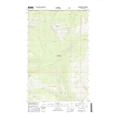
2017 Map of Bauerman Ridge
USGS Topo · Published 2017About this map
Bauerman Ridge dominates the high-country landscape along the international border between Washington State and British Columbia. This high-altitude terrain within the Okanogan National Forest is defined by its mining heritage and glacial hydrology, featuring names like Scheelite Pass and the mineral-rich locality of Tungsten. These labels point to a history of prospecting and extraction in a region where heavy minerals were once the primary driver of exploration.
Find a feature on this map
44 named features on this map. Tap any name to fly to it.
Don’t see what you’re looking for? This feature index may not catch every label — zoom into the map to look around manually.
Map Details
Editions of this 2017 Bauerman Ridge Map
This is the sole edition of this map. No revisions or reprints were ever made.
Other maps of this area

1906 · Chopaka
USGS Topo · 1:125,000

1954 · Okanogan
USGS Topo · 1:250,000

1955 · Concrete
USGS Topo · 1:250,000

1956 · Horseshoe Basin
USGS Topo · 1:62,500

1958 · Concrete
USGS Topo · 1:250,000

1958 · Okanogan
USGS Topo · 1:250,000

1962 · Concrete
USGS Topo · 1:250,000

1969 · Mt. Barney
USGS Topo · 1:24,000

1969 · Remmel Mtn.
USGS Topo · 1:24,000
1969 · Coleman Peak
USGS Topo · 1:24,000