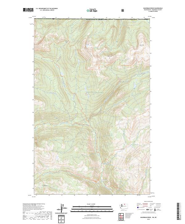
2023 Map of Bauerman Ridge
USGS Topo · Published 2023About this map
Bauerman Ridge and the surrounding high-altitude terrain of the Okanogan National Forest dominate this modern survey of the North Cascades. Located within the Pasayten Wilderness at the Canadian border, the area is defined by a dense network of trails and drainage systems, including the Chewuch River and several of its tributaries like Wave Creek and Fire Creek. The naming of Scheelite Pass and Scheelite Lake suggests a history of mineral exploration in these mountains, as scheelite is a primary ore of tungsten, further evidenced by the nearby Tungsten Trl. Settlement is nearly non-existent in this protected landscape, with Vic Meadow being the only named location of its kind. High points like Haig Mtn and Teapot Dome overlook the glacial basins that hold Pocket Lake and the headwaters of Horseshoe Creek.
Find a feature on this map
41 named features on this map. Tap any name to fly to it.
Don’t see what you’re looking for? This feature index may not catch every label — zoom into the map to look around manually.
Map Details
Editions of this 2023 Bauerman Ridge Map
This is the sole edition of this map. No revisions or reprints were ever made.
Other maps of this area

1906 · Chopaka
USGS Topo · 1:125,000

1954 · Okanogan
USGS Topo · 1:250,000

1955 · Concrete
USGS Topo · 1:250,000

1956 · Horseshoe Basin
USGS Topo · 1:62,500

1958 · Concrete
USGS Topo · 1:250,000

1958 · Okanogan
USGS Topo · 1:250,000

1962 · Concrete
USGS Topo · 1:250,000

1969 · Mt. Barney
USGS Topo · 1:24,000

1969 · Remmel Mtn.
USGS Topo · 1:24,000
1969 · Coleman Peak
USGS Topo · 1:24,000