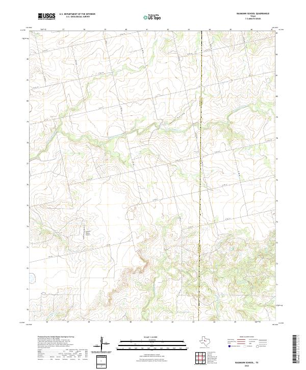
2022 Map of Baumann School
USGS Topo · Published 2022About this map
The rolling plains of West Texas are defined here by the drainage network of the S Fork Champion Cr, which carves through the central portion of the landscape. This area, straddling the border of Mitchell Co and Nolan Co, is a sparsely populated agricultural and ranching region crisscrossed by a grid of county roads. The terrain is marked by distinctive features like Hanks Hollow and several smaller waterways including Big Silver Cr and Red Bank Cr that feed into the larger creek systems.
Find a feature on this map
29 named features on this map. Tap any name to fly to it.
Don’t see what you’re looking for? This feature index may not catch every label — zoom into the map to look around manually.
Map Details
Editions of this 2022 Baumann School Map
This is the sole edition of this map. No revisions or reprints were ever made.
Other maps of this area

1950 · Colorado City SE
USGS Topo · 1:24,000

1952 · Colorado City
USGS Topo · 1:24,000

1954 · Big Spring
USGS Topo · 1:250,000

1958 · Big Spring
USGS Topo · 1:250,000

1959 · Pecan Crossing
USGS Topo · 1:24,000

1959 · Dam Draw
USGS Topo · 1:24,000

1969 · Baumann School
USGS Topo · 1:24,000

1969 · Bench Mountain
USGS Topo · 1:24,000

1969 · Loraine
USGS Topo · 1:24,000
1969 · Dew Drop Creek
USGS Topo · 1:24,000