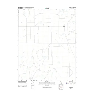
2012 Map of Bautista
USGS Topo · Published 2012About this map
Bautista sits at the intersection of a vast agricultural grid in the Texas Panhandle, where Moore County’s high plains meet the headwaters of the Canadian River watershed. This 2012 survey by the U.S. Geological Survey shows a landscape defined by industrial-scale farming and the seasonal hydrology of the region. Natural drainages like Big Blue Creek and Little Blue Creek cut through the geometric road network, providing crucial drainage across the flat plateau. The reliance on a systematic road layout is evident in the naming conventions of Middlewell Rd, Road W, and W Road X, which facilitate the transport of cattle and crops through this sparse settlement area. The map illustrates the persistent intersection of modern infrastructure, such as Co Hwy 2202, with the ancient, winding creek beds that remain the dominant natural features of the terrain.
Find a feature on this map
7 named features on this map. Tap any name to fly to it.
Don’t see what you’re looking for? This feature index may not catch every label — zoom into the map to look around manually.
Map Details
Editions of this 2012 Bautista Map
This is the sole edition of this map. No revisions or reprints were ever made.
Other maps of this area

1936 · Fourways
USGS Topo · 1:62,500

1953 · Marsh
USGS Topo · 1:24,000

1953 · Masterson
USGS Topo · 1:24,000

1954 · Tucumcari
USGS Topo · 1:250,000

1954 · Amarillo
USGS Topo · 1:250,000

1958 · Amarillo
USGS Topo · 1:250,000

1958 · Tucumcari
USGS Topo · 1:250,000

1963 · Bird Ranch Store
USGS Topo · 1:24,000

1963 · Stallwitz Lake
USGS Topo · 1:24,000

1965 · Dumas South
USGS Topo · 1:24,000