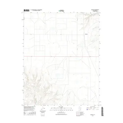
2016 Map of Bautista
USGS Topo · Published 2016About this map
Bautista sits at the transition between the high plains and the drainage systems of Moore County, where the landscape is defined by the headwaters of several critical watercourses. The local drainage pattern is marked by Big Blue Creek and Little Blue Cr in the northeast, while Little Indian Cr and Sand Cr cut through the southern reaches of the quadrangle. This 2016 survey illustrates a traditional Texas Panhandle layout of large-scale land divisions and straight-line corridors like Middlewell Rd and W Rd X. The topography reveals the intricate break in the plains where the land begins to drop into the Canadian River watershed, creating the complex contouring seen along the creek beds. Regional connectivity is maintained by FM r2707 and Road W, providing access across this sparsely populated ranching and agricultural region.
Find a feature on this map
9 named features on this map. Tap any name to fly to it.
Don’t see what you’re looking for? This feature index may not catch every label — zoom into the map to look around manually.
Map Details
Editions of this 2016 Bautista Map
This is the sole edition of this map. No revisions or reprints were ever made.
Other maps of this area

1936 · Fourways
USGS Topo · 1:62,500

1953 · Marsh
USGS Topo · 1:24,000

1953 · Masterson
USGS Topo · 1:24,000

1954 · Tucumcari
USGS Topo · 1:250,000

1954 · Amarillo
USGS Topo · 1:250,000

1958 · Amarillo
USGS Topo · 1:250,000

1958 · Tucumcari
USGS Topo · 1:250,000

1963 · Bird Ranch Store
USGS Topo · 1:24,000

1963 · Stallwitz Lake
USGS Topo · 1:24,000

1965 · Dumas South
USGS Topo · 1:24,000