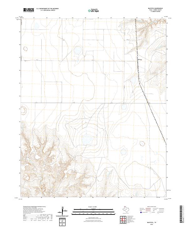
2022 Map of Bautista
USGS Topo · Published 2022About this map
Bautista and the high plains of Moore County are defined by a network of ephemeral drainages that carve through the Texas Panhandle landscape. In this 2022 survey, the terrain is marked by the branching paths of Big Blue Creek and Little Blue Cr in the northeast, while the southern reaches are shaped by Indian Creek and Little Indian Cr. The infrastructure reflects a rural ranching economy, with long straight stretches of Middlewell Rd and W Rd X following section lines across the open country. These roads, along with FM r2707, provide the primary access to the scattered homesteads and pastures that occupy this portion of the Llano Estacado, where water remains the most significant geographic feature.
Find a feature on this map
11 named features on this map. Tap any name to fly to it.
Don’t see what you’re looking for? This feature index may not catch every label — zoom into the map to look around manually.
Map Details
Editions of this 2022 Bautista Map
This is the sole edition of this map. No revisions or reprints were ever made.
Other maps of this area

1936 · Fourways
USGS Topo · 1:62,500

1953 · Marsh
USGS Topo · 1:24,000

1953 · Masterson
USGS Topo · 1:24,000

1954 · Tucumcari
USGS Topo · 1:250,000

1954 · Amarillo
USGS Topo · 1:250,000

1958 · Amarillo
USGS Topo · 1:250,000

1958 · Tucumcari
USGS Topo · 1:250,000

1963 · Bird Ranch Store
USGS Topo · 1:24,000

1963 · Stallwitz Lake
USGS Topo · 1:24,000

1965 · Dumas South
USGS Topo · 1:24,000