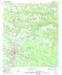
1970 Map of Baxley
USGS Topo · Published 1988About this map
Baxley serves as the focal point of this South Georgia landscape, revealing the town's structural layout during a period of steady growth. The town center is defined by the Southern railroad line and a grid of streets including Main St and Patterson St, which radiate from the central Courthouse and City Hall. Surrounding the urban core, the terrain is shaped by the winding course of Little Tenmile Creek and the waters of Dunns Lake.
Find a feature on this map
37 named features on this map. Tap any name to fly to it.
Don’t see what you’re looking for? This feature index may not catch every label — zoom into the map to look around manually.
Map Details
Editions of this 1970 Baxley Map
2 editions found
Other maps of this area

1953 · Waycross
USGS Topo · 1:250,000

1958 · Waycross
USGS Topo · 1:250,000
1970 · Altamaha
USGS Topo · 1:24,000

1970 · Baxley NE
USGS Topo · 1:24,000
1970 · Altamaha SW
USGS Topo · 1:24,000

1970 · Pine Grove
USGS Topo · 1:24,000
1970 · Grays Landing
USGS Topo · 1:24,000

1970 · Baxley
USGS Topo · 1:24,000

1971 · Surrency
USGS Topo · 1:24,000

1971 · Alma NW
USGS Topo · 1:24,000