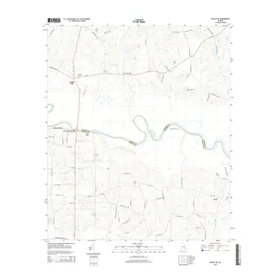
2014 Map of Baxley NE
USGS Topo · Published 2014About this map
The Altamaha River winds through the heart of this coastal plain landscape, defining the boundary between Toombs and Appling counties. This survey captures a region of family homesteads and river landings, anchored by the settlement of English Eddy and the crossing at the Joseph Simmons Alexander Senior Memorial Bridge. The rural character is punctuated by numerous family cemeteries, including Griner Cem, Mann Oquin Cem, and the Old Campground Cem, which offer significant value for genealogists tracing South Georgia roots. Terrain features like Falling Rocks and Piney Bluff rise above the river's path, while a network of named roads like Griner Cem Rd and Laura Dixon Rd connect the scattered farms and river outposts. Further south, the community of Davis sits near the headwaters of Roaring Cr, illustrating the area's deep ties to the river system and its various tributaries like Cobb Cr and Grace Br.
Find a feature on this map
77 named features on this map. Tap any name to fly to it.
Don’t see what you’re looking for? This feature index may not catch every label — zoom into the map to look around manually.
Map Details
Editions of this 2014 Baxley NE Map
This is the sole edition of this map. No revisions or reprints were ever made.
Other maps of this area

1953 · Waycross
USGS Topo · 1:250,000

1957 · Macon
USGS Topo · 1:250,000

1958 · Macon
USGS Topo · 1:250,000

1958 · Waycross
USGS Topo · 1:250,000

1964 · Macon
USGS Topo · 1:250,000

1970 · Johnson Corner
USGS Topo · 1:24,000

1970 · Alston
USGS Topo · 1:24,000

1970 · Reidsville West
USGS Topo · 1:24,000
1970 · Altamaha
USGS Topo · 1:24,000

1970 · Baxley NE
USGS Topo · 1:24,000