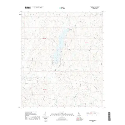
2018 Map of Baxterville NE
USGS Topo · Published 2018About this map
Gull Berry Brake and the surrounding wetlands of the Bay Cr drainage characterize this portion of Lamar County. The landscape is defined by an intricate network of watercourses, including Blue Springs Br, Sweetwater Br, and Half Moon Cr, which feed into the low-lying basins and brakes. Local heritage is centered around the Bay Creek Cem and a road system that reflects the rural economy, featuring routes like Purvis Oloh Rd and Purvis Columbia RD. Of particular interest to local historians is Tatum Salt Dome Rd in the southern sections, while the terrain in the west opens into the named valley of Hickory Hollow. The map also captures numerous family-named landmarks and local infrastructure, such as Lookout Tower Rd, providing a detailed look at the region's late-twentieth-century rural development.
Find a feature on this map
74 named features on this map. Tap any name to fly to it.
Don’t see what you’re looking for? This feature index may not catch every label — zoom into the map to look around manually.
Map Details
Editions of this 2018 Baxterville NE Map
This is the sole edition of this map. No revisions or reprints were ever made.
Other maps of this area

1953 · Hattiesburg
USGS Topo · 1:250,000

1958 · Hattiesburg
USGS Topo · 1:250,000

1964 · Purvis
USGS Topo · 1:24,000

1964 · Lumberton
USGS Topo · 1:24,000

1965 · Hattiesburg SW
USGS Topo · 1:24,000

1969 · Baxterville SW
USGS Topo · 1:24,000
1969 · Baxterville
USGS Topo · 1:24,000

1969 · Baxterville NE
USGS Topo · 1:24,000

1969 · Pinebur
USGS Topo · 1:24,000

1974 · Oloh
USGS Topo · 1:24,000