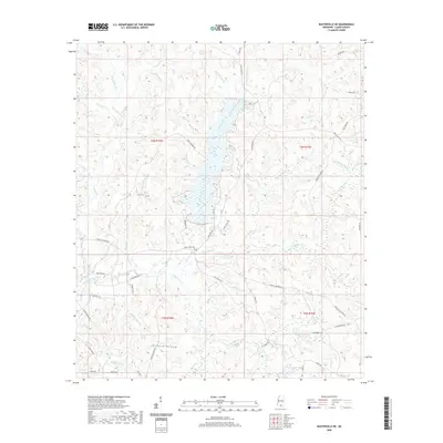
2020 Map of Baxterville NE
USGS Topo · Published 2020About this map
Bay Creek Cem sits at the heart of this Lamar County landscape, marking a quiet point of historical interest north of Hurricane Cr. The terrain is defined by a dense network of drainages and wetlands, including the extensive Gull-Berry Brake and the meandering Bondity Ponds Br. These watercourses create a complex topography of ridges and hollows, such as the notably named Hickory Hollow.
Find a feature on this map
66 named features on this map. Tap any name to fly to it.
Don’t see what you’re looking for? This feature index may not catch every label — zoom into the map to look around manually.
Map Details
Editions of this 2020 Baxterville NE Map
This is the sole edition of this map. No revisions or reprints were ever made.
Other maps of this area

1953 · Hattiesburg
USGS Topo · 1:250,000

1958 · Hattiesburg
USGS Topo · 1:250,000

1964 · Purvis
USGS Topo · 1:24,000

1964 · Lumberton
USGS Topo · 1:24,000

1965 · Hattiesburg SW
USGS Topo · 1:24,000

1969 · Baxterville SW
USGS Topo · 1:24,000
1969 · Baxterville
USGS Topo · 1:24,000

1969 · Baxterville NE
USGS Topo · 1:24,000

1969 · Pinebur
USGS Topo · 1:24,000

1974 · Oloh
USGS Topo · 1:24,000