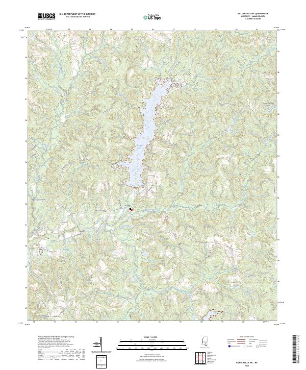
2024 Map of Baxterville NE
USGS Topo · Published 2024About this map
Big Bay Lake dominates the central landscape of this Lamar County region, its irregular shoreline defined by the confluence of numerous tributaries including Buck Branch and Driven Branch. This modern survey illustrates a topography of intricately carved drainages, where the headwaters of Hurricane Creek and Beaver Pond Branch create a dense network of ridges and hollows. Local family history is rooted in the surrounding countryside, anchored by the Bay Creek Cem and a road system that honors local names, such as Sodie Cameron Rd and Levi Bryant Rd. The terrain rises to landmarks like Grapevine Head Hill in the northeast, while the southern reaches are marked by the geologic signature of Tatum Salt Dome Rd near Hickory Hollow.
Find a feature on this map
81 named features on this map. Tap any name to fly to it.
Don’t see what you’re looking for? This feature index may not catch every label — zoom into the map to look around manually.
Map Details
Editions of this 2024 Baxterville NE Map
This is the sole edition of this map. No revisions or reprints were ever made.
Other maps of this area

1953 · Hattiesburg
USGS Topo · 1:250,000

1958 · Hattiesburg
USGS Topo · 1:250,000

1964 · Purvis
USGS Topo · 1:24,000

1964 · Lumberton
USGS Topo · 1:24,000

1965 · Hattiesburg SW
USGS Topo · 1:24,000

1969 · Baxterville SW
USGS Topo · 1:24,000
1969 · Baxterville
USGS Topo · 1:24,000

1969 · Baxterville NE
USGS Topo · 1:24,000

1969 · Pinebur
USGS Topo · 1:24,000

1974 · Oloh
USGS Topo · 1:24,000