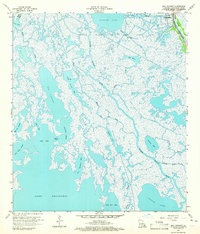
1964 Map of Bay Courant
USGS Topo · Published 1965About this map
Golden Meadow anchors the northeastern corner of this coastal Louisiana landscape, situated along the narrow corridor of Bayou Lafourche. This mid-century survey illustrates the intense intersection of natural wetlands and industrial expansion, dominated by the Golden Meadow Oil and Gas Field. The map reveals a complex web of waterways, from major outlets like Grand Bayou Blue and Bay Courant to smaller named features such as Chinaman Bayou and Bayou Pete de Ours. Local history is captured in the placement of the Sunnyside Cem and a Water Tank near the northern settlement. To the south, the terrain dissolves into the open waters of Lake Raccourci and Little Lake, separated by a labyrinth of marshes, passes like Chinois Pass, and secluded basins including Coal Tar Bay and Jean Plaisance Bay.
Find a feature on this map
32 named features on this map. Tap any name to fly to it.
Don’t see what you’re looking for? This feature index may not catch every label — zoom into the map to look around manually.
Map Details
Editions of this 1964 Bay Courant Map
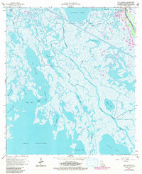
2 editions found
Other maps of this area

1892 · Cheniere Caminada
USGS Topo · 1:62,500

1892 · Creole
USGS Topo · 1:62,500

1894 · Timbalier
USGS Topo · 1:62,500

1894 · Lake Felicity
USGS Topo · 1:62,500

1935 · Viguerie Canal
USGS Topo · 1:31,680

1935 · Bay Courant
USGS Topo · 1:31,680

1935 · Golden Meadow
USGS Topo · 1:31,680

1935 · Pelican Pass
USGS Topo · 1:31,680

1935 · Mink Bayou
USGS Topo · 1:31,680

1935 · Leeville
USGS Topo · 1:31,680