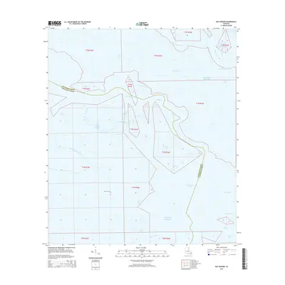
2015 Map of Bay Dosgris
USGS Topo · Published 2015About this map
Alombro Cem stands as a solitary land-based landmark amidst the expansive marshlands and tidal waters of the Mississippi Delta. The landscape is defined by a complex network of estuarine features where Bay Dosgris and Saint Joseph Bay meet the saltwater influence of the Gulf of Mexico. The boundary between Jefferson Parish and Lafourche Parish meanders through these wetlands, crossing significant waterways like Grand Bayou and the engineered Barataria Bay Waterway. This 2015 survey illustrates the delicate balance of coastal Louisiana, where named features like Hackberry Bay and Manila Bayou dominate a region primarily shaped by hydrology rather than human settlement. The map provides essential data for understanding the modern shoreline and the intricate drainage patterns of the lower bayou country.
Find a feature on this map
33 named features on this map. Tap any name to fly to it.
Don’t see what you’re looking for? This feature index may not catch every label — zoom into the map to look around manually.
Map Details
Editions of this 2015 Bay Dosgris Map
This is the sole edition of this map. No revisions or reprints were ever made.
Other maps of this area

1891 · Pointe a La Hache
USGS Topo · 1:62,500

1892 · Barataria
USGS Topo · 1:62,500

1892 · Creole
USGS Topo · 1:62,500

1892 · Pointe a La Hache
USGS Topo · 1:62,500

1893 · Fort Livingston
USGS Topo · 1:62,500

1935 · Mink Bayou
USGS Topo · 1:31,680

1935 · Wilkinson Bay
USGS Topo · 1:31,680

1939 · Pointe a La Hache
USGS Topo · 1:62,500

1941 · Barataria
USGS Topo · 1:62,500

1944 · Barataria
USGS Topo · 1:62,500