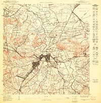
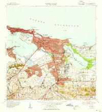
1950 Map of Bayamon SE
USGS Topo · Published 1950About this map
Bayamón serves as a dense urban core on this 1950 survey, anchored by the Estación Bayamón and the vital industrial grounds of Central Juanita. The landscape is defined by the winding course of the Río Bayamón and its tributaries, such as Río Hondo and Caño Frío, which cut through the agricultural and residential outskirts. The map reveals a transition from traditional rural life to modernization, shown through the presence of the American RR of Porto Rico and the Hospital de Distrito de Bayamón. To the north and east, substantial Reservación Militar lands neighbor the developing barrios of Juan Sánchez and Palmas. Significant local landmarks include the Cem Nacional de Puerto Rico and smaller settlements like Sabana Seca and Hato Tejas, offering a clear view of the municipality's spatial organization during the mid-century period.
Find a feature on this map
43 named features on this map. Tap any name to fly to it.
Don’t see what you’re looking for? This feature index may not catch every label — zoom into the map to look around manually.
Map Details
Editions of this 1950 Bayamon SE Map
This is the sole edition of this map. No revisions or reprints were ever made.
Other maps of this area

1941 · Bayamon
USGS Topo · 1:30,000

1941 · San Juan
USGS Topo · 1:30,000

1946 · Aguas Buenas
USGS Topo · 1:30,000

1946 · Naranjito
USGS Topo · 1:30,000

1947 · Aguas Buenas NO
USGS Topo · 1:10,000

1947 · Bayamon
USGS Topo · 1:30,000
1947 · Naranjito NO
USGS Topo · 1:10,000
1947 · Naranjito NE
USGS Topo · 1:10,000
1947 · San Juan
USGS Topo · 1:30,000
1949 · San Juan
USGS Topo · 1:30,000