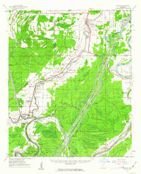
1961 Map of Bayland
USGS Topo · Published 1963About this map
Silver Creek and the Lower Auxiliary Channel dominate this Mississippi Delta landscape at the intersection of Sharkey, Humphreys, and Yazoo counties. The 1961 field check captures a network of rural communities and church-centered settlements like Holly Bluff, Louise, and Spanish Fort during an era of significant water management engineering. The map reveals the intricate drainage patterns of the Yazoo Basin, where the Sunflower River and Yazoo River frame fertile lowlands marked by numerous oxbow lakes such as Five Mile Lake and Broad Lake. Genealogists will find a wealth of family and community landmarks, including the Humphreys Co Training School, several Indian Mounds, and numerous small burial grounds like Huddleston Cem and Kettleman Cem. The infrastructure of the Illinois Central railroad still serves as a primary transit corridor connecting remote hamlets like Craig and Patosi to larger agricultural centers.
Find a feature on this map
80 named features on this map. Tap any name to fly to it.
Don’t see what you’re looking for? This feature index may not catch every label — zoom into the map to look around manually.
Map Details
Editions of this 1961 Bayland Map
3 editions found

Other maps of this area

1939 · Onward
USGS Topo · 1:62,500

1939 · Lorenzen
USGS Topo · 1:62,500

1939 · Swan Lake
USGS Topo · 1:62,500

1940 · Auter
USGS Topo · 1:62,500

1940 · Mechanicsburg
USGS Topo · 1:62,500

1940 · Mileston
USGS Topo · 1:62,500

1953 · Greenwood
USGS Topo · 1:250,000

1954 · Mileston
USGS Topo · 1:62,500

1955 · Jackson
USGS Topo · 1:250,000

1956 · Greenwood
USGS Topo · 1:250,000