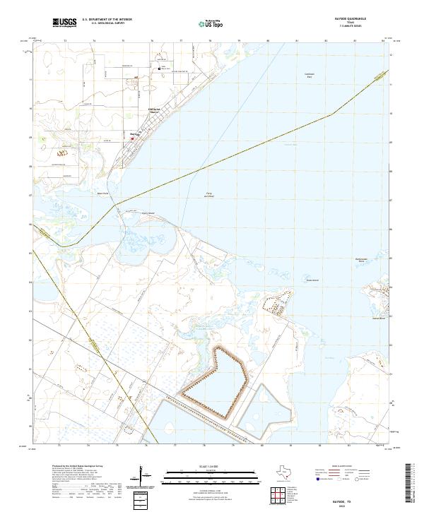
2022 Map of Bayside
USGS Topo · Published 2022About this map
The coastal transition of Refugio County is defined by the sweeping waters of Copano Bay and the specialized infrastructure along the shoreline. In the 2020s, the community of Bayside remains the primary settlement, while the location of Old Saint Marys marks the site of an earlier port and town. Cultural history is anchored by Saint Mary's Cem near Bayside Cemetary Rd, providing a point of reference for genealogists and local historians studying early Texas Gulf Coast families.
Find a feature on this map
56 named features on this map. Tap any name to fly to it.
Don’t see what you’re looking for? This feature index may not catch every label — zoom into the map to look around manually.
Map Details
Editions of this 2022 Bayside Map
This is the sole edition of this map. No revisions or reprints were ever made.
Other maps of this area

1925 · Aransas Pass
USGS Topo · 1:62,500

1925 · Corpus Christi
USGS Topo · 1:62,500

1950 · Corpus Christi
USGS Topo · 1:250,000

1951 · Corpus Christi
USGS Topo · 1:62,500

1953 · Beeville
USGS Topo · 1:250,000

1954 · Rockport
USGS Topo · 1:62,500

1954 · Aransas Pass
USGS Topo · 1:24,000

1954 · Woodsboro
USGS Topo · 1:62,500

1954 · Estes
USGS Topo · 1:24,000

1954 · Aransas Pass
USGS Topo · 1:62,500
Featured Places
- Bayside, TX
- Bayview Estates Colonia, TX
- Old Saint Marys, Bayside
- San Patricio County, TX
- Aransas County, TX