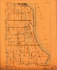
1891 Map of Bayview
USGS Topo · Published 1896About this map
Bay View and the surrounding shoreline of Lake Michigan appear here during a transformative era of rail development in the late nineteenth century. The landscape is defined by the heavy infrastructure of the Chicago and Northwestern Railroad and the Chicago Milwaukee and St. Paul Railroad, which run parallel to the coast and connect the burgeoning settlements of Oak Creek and Caledonia.
Find a feature on this map
27 named features on this map. Tap any name to fly to it.
Don’t see what you’re looking for? This feature index may not catch every label — zoom into the map to look around manually.
Map Details
Editions of this 1891 Bayview Map
2 editions found
Other maps of this area

1891 · Bayview
USGS Topo · 1:62,500

1891 · Muskego
USGS Topo · 1:62,500

1892 · Milwaukee
USGS Topo · 1:62,500

1892 · Waukesha
USGS Topo · 1:62,500

1892 · Racine
USGS Topo · 1:62,500

1893 · Silver Lake
USGS Topo · 1:62,500

1901 · Milwaukee
USGS Topo · 1:62,500

1901 · Waukesha
USGS Topo · 1:62,500

1901 · Bayview
USGS Topo · 1:62,500

1901 · Muskego
USGS Topo · 1:62,500